
The era of information technology is in full swing. Data on a host of issues from housing prices to the environment is now available with a quick Google search. The scope of information might overwhelm any human brain, but not artificial intelligence. AI can synthesize data and make decisions with the click of a button. And like it or not, it is quickly becoming a part of everyday life.
AI may have recommended the movie you watched on Netflix the other night. It may be monitoring the heating cooling system in your house. It may have even been doing your child’s homework last night. While some of these uses may be controversial, AI has one application most of us would support: helping us win the fight against wildfires.
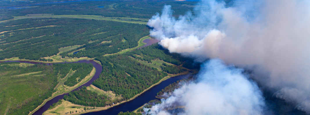
Wildfires are unpredictable and move quickly. Artificial intelligence helps land managers and firefighters win the upper hand. With help from AI, responders can predict, control, and learn from fires, allowing the United States to adapt to its changing climate.
This post is the second in a series of innovations in wildfire response. The first piece explores the emerging field of detecting wildfires from space and focuses specifically on the development of new satellite technology. Satellites designed for wildfire detection rely on machine learning to process images of fire-prone areas on Earth’s surface. This piece aims to show how the coupling of detection technologies–like satellites–and AI have the potential to drastically change the way we prepare for, respond to, and recover from wildfire events.
AI can help prevent wildfires in the first place
The time before a fire starts is actually the most crucial time for action. This may seem counterintuitive, but preventing a fire can result in the protection of natural resources, communities, and human lives. Fire managers engage in different strategies to reduce the likelihood of a wildfire event. These include forest thinning, controlled burns, and encouraging landowners to perform fire mitigation on their own properties. These practices can help prevent wildfires from ravaging communities. However, many prevention tools are useless if responders don’t know where or when to use them. This is where AI comes through.
Researchers at Aalto University in Finland have used machine learning to develop a wildfire prediction model that correctly predicts fires 80–95 percent of the time. It takes into account 31 variables, including land cover, regional vegetation, drought indices, daily cloud cover, and distance to settlements. As they continue to hone the algorithms, the research team is also exploring ways to use the model to inform land management practices.
Similarly, other researchers are utilizing machine learning to predict crucial fire elements. The Climate Forecasting System (CFS) uses climate and weather data to predict wildfire danger in the western US. Their latest prediction system, CFS-SR, significantly increases the predictability of wildfire events up to 14 days in advance.
Geographical and weather-related data can also be used for other preventative measures. Forest managers can use AI tools to better plan prescribed burns. WIFIRE Labs, a team of computer scientists at the University of California, San Diego, have used machine learning to create a map that models fires in real time. Their map uses data to predict the trajectory and burn path of fires. These predictions can be used when planning prescribed fires to anticipate potential risks and ensure burns are safe and effective.
Prescribed burns can create uncertainty for many people who live in fire-prone areas. For example, last year’s Hermit Fire in New Mexico started as a prescribed burn, but when unexpected wind patterns caused the fire to grow out of control, it ended up destroying over 100 homes and hundreds more structures.
Events like the Hermit Fire erode the public’s trust in planned fires. While the idea of starting fires for prevention may seem risky, prescribed burns rarely grow out of control (99.84 percent go as planned). Even so, WIFIRE’s Firemap can account for wind patterns and lessen the probability of future events like the Hermit Fire. With the need for healthier forests more important than ever, AI is paving the way for a future where controlled burns can be a widely used solution to overgrown forests.
AI aids suppression efforts while fires burn
Once a fire ignites, responders’ strategies must immediately change from prevention to suppression. If a fire can be quickly identified, it is far easier to contain. If response times are slow, fires are more likely to devastate neighboring communities. Machine learning, when coupled with various detection technologies, is cutting the time between ignition and detection.
Descartes Labs, a geospatial intelligence group, uses AI for wildfire detection. Their algorithms rely on satellite technology to identify abnormalities in thermal infrared data. If abnormalities are found, they are then cross-checked by successive algorithms to ensure accuracy. Once a fire is confirmed, the software alerts fire managers via text message. Descartes Labs’ system has proven effective, identifying over 6,000 fires, some in just nine minutes.
Other groups are mixing AI with other detection methods. ALERTWildfire relies on a system of tower-mounted cameras and AI to detect fires. The detection group started as a research project in the Lake Tahoe Basin and is now sponsored by many western universities. The program has experienced fast growth over the past 10 years. With outside support, they have installed over 700 cameras across six states. ALERTWildfire’s cameras photograph wildlands and send them to nearby fire emergency centers. Then an AI software compares side-by-side images to identify discrepancies in present locations. The system has honed in on speed and beats civilian reports by up to ten minutes.
Apart from faster response times, AI helps firefighters know where to place fire breaks while a fire burns. Fire breaks—manmade strips of open land in a forest—are powerful tools that can curb the spread of fire. The ideal fire break size and placement depends on geography and weather patterns of an area. Traditionally, fire managers place fire breaks according to their “best guess” of how a fire will move. AI can gather and interpret predictive data to better inform firefighters in creating effective fire breaks.
One such tool is already doing this. Potential Control Locations (PCL) is an analytical tool developed by researchers and professors. Its algorithm predicts the best available fire break locations on public lands. The algorithm takes into account variables including distance from roads, topography, fuel types, and historical fire perimeters. Each variable is important when deciding on a location for a fire break. AI tools are much more capable than mere mortals at analyzing all of these variables together. This allows fire managers to better predict the ideal placement for fire breaks.
AI helps communities recover from wildfires
Even after a fire has finished burning, AI can aid communities in the recovery process. Researchers at Stanford University are using AI to identify buildings damaged by wildfires. Their goal is to to speed up recovery for communities post-fire. The program, DamageMap, uses image comparison to assess damage. Responders can pull pre- and post-fire images from satellites, drones, and aerial photography. The map marks blackened surfaces, cave-ins, or buildings that have disappeared completely.
From there, damage is sorted into four categories: almost no damage, minor damage, major damage, or destroyed. While this AI tool doesn’t do anything a fire responder couldn’t, its competitive edge lies in its speed and accuracy. Door-to-door checks of an area can take days or even weeks depending on an area’s population. DamageMap’s big picture assessment only takes a few hours. Additionally, the program can identify damaged buildings with 92 percent accuracy. The AI-based application minimizes groundwork, saving responders time and resources.
DamageMap helps speed up the decision-making process for first responders. If a structure is deemed unsafe, the rebuilding process can begin much quicker, thanks to DamageMap’s analysis. AI tools can also assist property owners in gathering information about the extent of damage done to their homes or places of business. This information is helpful for filing insurance claims.
AI’s application to the realm of wildfires is diverse, and it is quickly becoming an asset in every stage of wildfire response. Whether pre-, mid-, or post-fire, AI tools are providing data and simplifying decisions for fire responders. As innovators continue to push the boundaries of data analysis and machine learning, policymakers and government agencies would do well to save a spot for AI and its ability to combat wildfires. By doing so, fire managers and firefighters can better prepare for and respond to wildfires, protecting the lives and property of Americans.